
Resources such as “Google Maps” and official tourism maps (see notes below) allowed us to organize and program the activities and touring we would undertake daily during our stay in Spain. It also helped in determining how much we would need for each city and identify where to locate a command center to serve as home base for all our touring.
How did we go about this? We first surfed the internet in search of detailed maps for the different regions of Spain. We would highlight the cities to visit and began work on planning the trip. Google map features in addition to providing instructions as to how to get around can also indicate the estimated time needed (walking, driving, public transportation) for a place such as Seville. With the information gathered we gained a general idea of what it would take to perform the tours in terms of distance, days needed for each city and even how much time we could spend at each site visited.

This general information also allowed us to get back to our main map and structure small walking tours centered on the places of interest we wanted to visit. That’s how we came up with many small tours such as the ones we designed for the “Buen Retiro” park, the Royal Palace, the different museums and even for some night life. The smaller tours enabled us to focus on what was to be visited, what would be viewed, were and when to have coffee o have some tasty “tapas”. The was always room for sudden adventures within each tour.

Of course planning and organizing a trip on your own can be a lot of work. However, the satisfaction of planning the trip to our pleasure and stress free is priceless. The flexibility to enjoy and appreciate those things that can only be found in walking freely is also priceless.
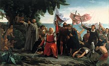
If Christopher Columbus spent the same effort in planning his voyage westward towards the Indies. With the limited resources he had available, he plotted his course. Guided by the stars, he embarked on his trip of a lifetime. He defined his destination, projected the distance and time it would take to complete the voyage in order to determine what and how much supplies he would need for his conquest. With all the resources we have at hand today, our conquest is assured.
Notes:
- http://www.orangesmile.com/geolocation/en/sightsmap_full.php – This web site is a good tool for indepent travelers for starters and help identify places of interest. It is of easy use and allows the slection of places of interest by different categories.
- Google Maps – A resource which enables the identification of places of interest, instructions for getting to them with several alternate routes and provide a timetable. However, we discovered that on occasion, certain places might be slight off in their location on the maps. Nevertheless, we recommend using this site.
- Local Tourism Offices of the different cities can provide official maps which highlight iconic sites in addition to other places of interest, some are include in exchange for a commission (restaurants and stores mainly). The defect resides in that some small hidden gems of the cities are omitted.